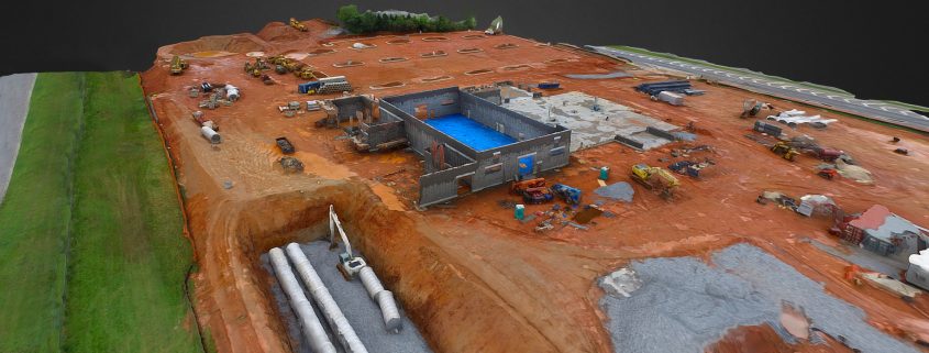
Aerial construction monitoring via unmanned aerial vehicles (UAVs), also known as drones, enable clients in Marietta, Georgia to see conditions that would be impossible to see by simply walking the construction site. Aerial drones are more flexible and considerably less expensive than hiring a helicopter.
Building Diagnostics Group (BDG), founded in 2002, is an industry leader in aerial infrared imaging and commercial building thermal inspection services. Our specialty is the non-destructive detection, investigation and resolution of water intrusions.
BDG’s aerial construction monitoring services involve the collection of site data at predetermined intervals or specific project milestones for analysis by construction managers, owners and stakeholders using a variety of tools, such as photorealistic 3D models, surface and volume measurements, BIM comparisons and timeline data.
Our Fleet
BDG maintains a fleet of four DJI Inspire and Matrice aircraft that are deployed by our FAA Authorized Commercial Drone Remote Pilots based on the specifics of each particular mission.
The drones are specially equipped with high-resolution FLIR camera systems and feature a Zenmuse XT 640×512 resolution radiometric infrared camera that is capable of producing high-resolution images and video.
We provide as many photos and videos as necessary to capture the entire construction site from all angles and perspectives. They can be uploaded to our cloud reporting platform to produce a large format stitched image or a 3D model that can easily be annotated, measured, and shared with others.
How Aerial Services Can Be Used in Construction
Construction projects are complicated, time-consuming and resource-intensive. Drones can access remote locations, complete safety inspections, document the progress of a project, and more:
Roof inspections: Aerial infrared roof inspections are performed to identify the condition of a building’s roof and assess any defects. Getting access to a roof can be challenging and dangerous, often involving ladders and scaffolding. BDG uses small drones to detect and document areas of moisture for further investigation and repair.
Land surveying: Drone innovation has made land surveys much more cost-effective and efficient. Aerial surveying provides you with accurate details about the landscape and surrounding areas, enabling you to make informed estimates and decisions before breaking ground. Drones also have the ability to reach high-risk areas and tight locations that can be difficult to reach with a human crew.
Monitoring job progress: Aerial construction monitoring is a faster way of documenting overall progress on the construction site in real time and identifying the parts of the project that are going off-track. Aerial imaging can make investors and clients feel a part of the process, even when they are miles away. It is also an excellent way to monitor multiple jobsites without having to constantly shuttle from one site to another.
Maintenance inspections: Performing planned or reactive maintenance inspections on high structures such as bridges, water towers, telephone masts, and other elevated structures can be costly and dangerous for site personnel working at height. Drones offer a quicker and easier way of carrying out these inspections and providing real-time data to engineers or surveyors on the ground.
Gain more control over your Marietta, Georgia project with aerial construction monitoring services from Building Diagnostics Group. For more information about our services or receive a quote, please get in touch with us at (888) 317-4568 to discuss your project.


