Thermal infrared aerial imagery has become a powerful tool for building inspections and can help you or your company make the right decisions regarding a project or asset by quickly identifying the cause and origin of roof and building failures.
Building Diagnostics Group (BDG), headquartered in Atlanta, Georgia, specializes in the non-destructive detection, investigation, and resolution of water intrusions on commercial, industrial, institutional and multi-family buildings.
Our expertise in thermal infrared aerial imagery, or aerial infrared thermography, as well as infrared building science and water testing procedures, are invaluable to architects, property developers, insurance companies and others.
What is Aerial Infrared Thermography?
Aerial thermography is a method of using aerial systems and specialized infrared camera equipment to measure the quantity of heat being emitted from an object and convert it to a digital image.
Infrared radiation is emitted by all objects, and the amount of radiation increases with temperature. Thermographic cameras detect this radiation in a way similar to how an ordinary camera detects visible light. The radiation is converted into visible high-resolution images that make it possible to “see” variations in temperature with or without visible illumination.
How is Aerial Infrared Thermography Used?
Originally developed for military use during the Korean War, thermal imaging cameras have become an important tool in a wide variety of industries.
Firefighters use aerial thermal imaging to see through smoke, locate fire hotspots, and conduct search and rescue operations. Police departments use the technology for surveillance, to investigate crime scenes, and to locate and apprehend suspects. (One of the Boston Marathon bombing suspects was apprehended when aerial thermal imaging found him hiding under a tarp in a boat.)
Municipalities use aerial thermal imagery to locate possible water pollution sites. The technology is highly effective for monitoring irrigation on large acreage farms. Power line maintenance technicians use aerial thermography to locate overheating joints and parts to avoid potential power failures, and building technicians use it to find heat leaks that affect cooling and heating efficiency.
There are endless applications for aerial thermography, including:
- Commercial roof inspections
- Solar panel field surveys
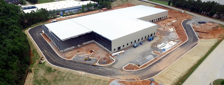
- Construction site monitoring
- Building energy performance surveys
- Transmission line inspections
- Agricultural surveys
- First responder services (e.g., following hurricanes, floods, tornados)
What Equipment Do We Use?
FLIR Systems, the world’s leader in thermal imaging equipment, developed a thermal imaging camera system that mounts to a commercial drone. Building Diagnostics Group’s FLIR equipped aerial drones feature a Zenmuse XT 640×512 resolution radiometric infrared camera that is capable of producing high-resolution images and video.
We have the ability to thoroughly inspect building facades, roofs, solar panels, cell phone towers, water towers, wind turbines, power lines, and many other objects while maintaining a safe distance from the target.
While most thermographers use cameras with resolutions of at least 320×240 or 76,800 pixels, BDG uses only high-resolution imagery systems that produce at least 640×480 lines of resolution (307,200 pixels), and with our advanced system, the T1020, 1024×768 lines of resolution (786,432 pixels). We are also skilled in proper image capture, data interpretation, and have extensive construction knowledge.
If you need to conduct building condition assessments or locate roofing issues anywhere in the nation, take advantage of thermal infrared aerial imaging services from Building Diagnostics Group. To receive a quote or get more information, contact us at (888) 317-4568 with the details of your project.

